Geographical position and relief
The Khanty-Mansiysk Autonomous Okrug occupies the central part of the West Siberian Lowland, stretching from west to east for almost 1,400 km - from the Ural Range to the Osko-Yenisei watershed. From north to south, the district extends for approximately 800 km, located between 58? 30' and 65? 30' north latitude. The length of the borders of the district is 4750 km. The territory of the district is a vast, slightly dissected plain with absolute elevations rarely reaching 200 m above sea level. The only exception is the North-Sosvinskaya Upland, located in the northwestern part, between the Ural Range and the Ob, and passing along the northern border of the district, a barely elevated ridge of Siberian ridges, which is a natural watershed between the basins of the Ob rivers and Nadym, Pura, going in a submeridian direction to the north. and Taza. The moraine ridges also include the more modest-sized Agansky ridge and Numto ridge. Of particular note is the most interesting natural formation, called the Belogorodsky mainland. It is a hill, stretching in a submeridional direction, bounded from the west by the Ob River, and from the east bordered by the valley of the Nadym River. The maximum heights (up to 231 m) gravitate towards the strongly dissected "mountainous" part of the Ob, in the east the relief is poorly dissected. The northern part (to the north of the village of Maly Atlym) is characterized by heights of 190-230 m and significant erosional dissection. In the south, elevations rarely exceed 100-130 m. Belogorie got its name for the light color of the clays that make up the elevation. The Belogorsk mainland and its less pronounced continuation already in the Ob-Irtysh interfluve separate the vast Kondinsky and Surgut lowlands - the true kingdoms of lakes and swamps. In the west, the spurs and ridges of the mountain system of the Northern and Subpolar Urals enter the territory of the district. This part of the okrug's territory is characterized by low- and medium-mountain relief (in the Subpolar Urals - with alpine features). The length of the mountainous region is 450 km with a width of 30-40 km. Within the mountain system of the Subpolar Urals, on the border with the Komi Republic, there are maximum marks of absolute heights in the Khanty-Mansi Autonomous Okrug - up to 1,895 m (Narodnaya).
Climate
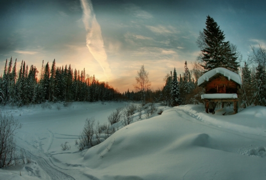
The climate of the district is temperate continental, characterized by a rapid change of weather conditions, especially in autumn and spring, as well as during the day. The formation of the climate is significantly influenced by the protection of the territory from the west by the Ural Range, as well as the openness from the north, which contributes to the unhindered penetration of cold Arctic masses. An important role is played by the flat character of the terrain with a large number of rivers, lakes and swamps. Winters are severe and long with stable snow cover, summers are short and comparatively warm. The transitional seasons (spring, autumn) are characterized by late spring and early autumn frosts. The average temperature in January in the district ranges from 18-24 ?C. Most low temperatures air (up to -60-62 ? C) were registered in the valley of the Vakh River in the Nizhnevartovsk region. The duration of the period with negative air temperature can reach 7 months, from October to April; with stable snow cover - 180-200 days - from late October to early May. Frosts are not uncommon until mid-June. The warmest month of July is characterized by average temperatures from 15.0 ?C (in the northwest) to 18.4 ?C (in the southeast). The absolute maximum reaches 36?C. The annual duration of sunshine in the district is 1600-1900 hours, in Khanty-Mansiysk - 1765 hours (for comparison: in St. Petersburg - 1563, Kursk - 1775, Kyiv - 1843 hours).
In summer, the prevailing wind direction is northerly, in contrast to winter, when southerly winds are more often observed. The annual rainfall is 400-620 mm. The height of the snow cover is from 50 to 80 cm. The maximum precipitation falls on the warm season. Even with a relatively small amount of them, the evaporation values are very insignificant, as a result of which the entire territory of the region is located in the zone of excessive moisture. Waterlogging, low temperatures, late spring, summer and early autumn frosts - all this hinders the cultivation of most crops. Only focal agriculture is widespread, specializing in the cultivation of potatoes, onions, radishes, cabbages, carrots, oats, barley, and fodder crops.
Hydrography
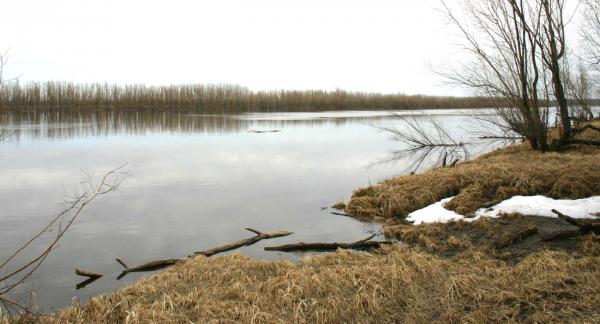
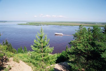 There are more than 2,000 large and small rivers on the territory of the Okrug with a total length of 172,000 km. The main rivers of the Khanty-Mansi Autonomous Okrug - the Ob (3650 km) and the Irtysh (3580 km) - are one of the largest rivers in Russia. In addition to them, significant rivers include the tributaries of the Ob: Vakh, Agan, Tromyogan, Bolshoy Yugan, Lyamin, Pim, Bolshoy Salym, Nazim, Northern Sosva, Kazym, as well as the tributary of the Irtysh - the Kondu and Sogom rivers. There are more than 10 rivers in the district, the length of which exceeds 500 km. Each of them, due to its size, special beauty, and richness in fish resources, could become the national pride of many countries of the world. The Konda River, for example, is almost equal in length (about 1100 km) to the Rhine, the Bolshoi Yugan (1063 km) is only 5 km shorter than the Vistula, and the full-flowing Vakh (964 km) is significantly longer than the Oder. All the rivers of the district, excluding the rivers of the Ural part, are characterized by small slopes, low flow rates, spring-summer floods, floods in the warm season, backwater phenomena. The Ob backwaters extend to a distance of 700-200 km from the mouth of the tributaries, which contributes to the formation of lars (floodplain swamps) and sors (seasonal lakes formed in flooded lowlands).
One third of the territory of the district is occupied by swamps, mainly of upland and transitional type. Surrounded by swamps and forests, there are about 290 thousand lakes with an area of more than 1 hectare. The largest of them (more than 100 sq. km) are Tursuntsky and Levushinsky Tumany, Vandemtor and Trememtor. The deepest are Kintus (48 m), Syrkovy Sor (42 m). Most of the lakes (about 90%) are small in area and rather shallow, having no surface runoff.
Soils
The soil cover is not very diverse. Podzolic soils are common in riverine drained areas under dense dark coniferous taiga. On watersheds with weak surface and ground runoff, different kinds gley soils, which are usually replaced by bog soils in the central part. Thin podzolic soils of light mechanical composition are characteristic of the areas of spread of sandra; on them, as a rule, reindeer moss pine forests grow. The Ob floodplain is characterized by a complex combination of alluvial, soddy-meadow and marsh soils. In the mountainous (Ural) part, tundra coarse-humus gravelly soils are common.
Flora
The flora of the Khanty-Mansiysk Okrug includes over 800 species of higher plants. Almost the entire territory of the district is located within one natural zone - taiga forests, only in the extreme north-west in the Urals part it enters the zone of forest tundra and mountain tundra. Most of the territory is occupied by heavily swamped taiga. The vegetation is represented by communities of mixed and coniferous forests, swamps, water meadows, reservoirs, and mountain tundra. In the northern regions, the composition of vegetation is greatly influenced by permafrost. The forest cover of the territory is 52%. The zone of middle taiga dominates, which is represented by dark coniferous, light coniferous, small-leaved and mixed forests. Spruce, cedar, fir, pine, larch, birch, alder grow in them. Of particular note are the extensive light lichen forests widely distributed in the northern regions of the district, used as reindeer pastures. River floodplains and lowlands are characterized by meadow vegetation. High floodplains of large rivers are often covered with park-type willow forests, willow-birch, willow-birch-aspen grass forests. Forests and swamps are rich in berries: cranberries, lingonberries, blueberries, blueberries, currants, cloudberries, raspberries, wild roses, bird cherry, mountain ash. About 200 plant species are used in indigenous traditional medicine.
Fauna
The fauna of the district is typical for the taiga zone of Russia. The vertebrate fauna includes 369 species. Mammals are represented by 60 species, 28 of which are commercial. The most common and economically valuable are: fox, arctic fox, squirrel, sable, marten, ermine, weasel, polecat, mink, weasel, otter, hare, wild reindeer, elk, etc. The wolverine and the West Siberian river beaver.
The avifauna of the Okrug is represented by 256 species of birds, including 206 sedentary and nesting species. The most numerous orders are Passeriformes, Charadriiformes and Anseriformes. The basis of the hunting fauna (48 species) is formed by geese, capercaillie, black grouse, hazel grouse, partridges, ducks, sandpipers. Of the predators, the vulture hawk, the marsh harrier, and the long-eared owl should be especially noted. There are rare species listed in the Red Book: curly pelican, black stork, common flamingo, lesser white-fronted goose, golden eagle, peregrine falcon, black crane, Siberian Crane (white crane), thin-billed curlew, white-tailed eagle, osprey, gyrfalcon, black goose, red-breasted goose. There are 42 species of fish in rivers and lakes. Of these, only 19 are commercial - sterlet, lelma, muksun, peled (cheese cheese), broad whitefish (shokur), whitefish (pyzhyan), Sosvinskaya herring (tugun), burbot, pike, ide, roach, bream, dace, perch, ruff , golden and silver carp, and carp are grown in the cooling ponds of the Surgut and Nizhnevartovskaya state district power stations. The species listed in the Red Book is the sturgeon.
The county is infamous for the abundance of mosquitoes and midges. A huge number of blood-sucking insects is a significant hindrance for pets and working on outdoors of people. So, for example, the average number of adult mosquitoes in the forest area in the Ob and its tributaries is from 4 to 12 specimens per 1 sq.m of territory. Mosquitoes appear in late May - mid-June, and their mass departure occurs in early July. By the end of August, the number and activity of mosquitoes are significantly reduced. The period of the greatest activity of midges, when they attack people, falls on the second half of summer.
Natural resources
The district has a huge natural resource potential. First of all, these are oil and gas reserves, forest resources, as well as a number of solid minerals. More than 400 oil and gas-oil fields have been discovered with reserves of about 20 billion tons. The predicted oil reserves are estimated at 35 billion tons. The largest oil fields include Samotlor (one of the ten largest in the world), Fedorovskoye, Mamontovskoye and Priobskoye. As a rule, associated gas is present in oil fields - the most valuable raw material for the chemical industry. Unfortunately, most of it is still burned in the fields, a smaller part is used as fuel at the largest thermal power plants (Surgut GRES-1 and GRES-2). In terms of natural gas reserves, the Khanty-Mansi Autonomous Okrug ranks second in Russian Federation after the Yamalo-Nenets Autonomous Okrug.
In addition to oil and gas deposits, the wealth of the region is also made up of deposits of primary and placer gold, the predicted reserves of ore formations of which are estimated at 220 tons. In the part of the Autonomous Okrug adjacent to the Urals, deposits of iron ore, as well as occurrences of bauxite, copper, zinc, lead, niobium, tantalum, etc. Industrial development of deposits of vein quartz, rock crystal and piezoquartz is underway. The quality of these raw materials is one of the highest in the world. There are known deposits of brown and hard coal, the estimated reserves of which are estimated at 4600 and 970 million tons, respectively. There are deposits decorative stone, brick and expanded clay, building sand, sand and gravel mixture, valuable agrochemical raw materials - sapropel, innumerable reserves of peat. Huge resources of fresh, mineral and thermal underground waters, which are still used insignificantly.
Yugansky reserve
Obrazov in 1982 as the largest reserve of taiga landscapes. It occupies an area of 648.7 thousand hectares, has a two-kilometer protected zone along the perimeter with an area of 98.9 thousand hectares. The territory of the reserve includes part of the basins of the rivers Negusyakh and Small Yugan - the right tributaries of the Big Yugan. The central estate of the reserve is located on Utug, the largest of the nearby settlements. Not far from the boundaries of the reserve, along the rivers, a few Khanty families traditionally live.
The Yugansky reserve is located in the subzone of the middle taiga, where the most typical areas are hazel-moss dark coniferous forests in combination with long-moss and sphagnum forests. Along the valleys of rivers and streams, there are peculiar taiga formations - urmans, in which spruce or cedar predominate in the vicinity of fir, birch, mountain ash, bird cherry. Pine forests are also widespread, sometimes combined with sphagnum bogs (ryams). The slopes of the ridges and river valleys are covered with picturesque shrub forests with a predominance of lingonberries and wild rosemary. Birch-aspen forests with undergrowth of wild rose and goat willow are confined to river floodplains, combined with areas of meadow vegetation. Grass-forb, sedge-canary and marsh-sedge meadows stretch here. About 40 species of taiga mammals live in the Yugansky Reserve. The most common are elk, brown bear, sable, squirrel, chipmunk, otter, pine marten, ermine, mountain hare, fox, Siberian weasel and wolverine. In some years, arrivals of arctic foxes and wild boars are noted. Acclimatized species - the muskrat and the American mink - are widely settled. The avifauna includes more than 180 species, of which the capercaillie, black grouse, hazel grouse, white partridge, sandpipers, woodcocks, snipe, ducks, predatory owls, cuckoos, woodpeckers predominate. There are also rare birds: eagle owl, black-throated diver, gray crane, black kite, goshawk, sparrow hawk, whooper swan, black swift.
Occasionally, birds listed in the Red Book of the Russian Federation fall into the field of view of naturalists: white-tailed eagle, golden eagle, osprey, black stork, red-breasted goose, peregrine falcon. Reptiles are represented by the common viper and viviparous lizard, amphibians - by the Siberian frog and moor frog, Siberian salamander. On the territory of the reserve, ten species of fish are permanently inhabited. Pike, perch, ruffe, roach, ide, dace, golden and silver carp, as well as gudgeon and minnow are found in various reservoirs of the reserve. In the Bolshoy Yugan, nelma and burbot are sometimes caught.
STORY
Ugra in antiquity (VIII millennium BC - early I millennium AD)
The vast expanses of the West Siberian Plain and the lower Ob region are considered one of the most recently settled territories. The first evidence of pra-residents of these places dates back to the Mesolithic (Middle Stone Age) - VIII-VI centuries. BC. according to the most common version, the first inhabitants of the region were the ancient Urals (ancestors of the Ugric peoples, Finns and Samoyeds). The settlement of the territory was probably carried out by waves of different times from adjacent regions, mostly from the forest-steppe zone of Western Siberia - the most probable ancestral home of the Ugric peoples, where in the Neolithic period (4th millennium BC) the ancestors of all the peoples related to modern Khanty and Mansi formed a single Proto-Finno-Ugric generality.
In the II millennium BC. In connection with the warming of the climate, the border of the steppes began to move to the north, respectively, pastoral tribes began to move north, gradually mixing with the taiga aborigines along the way. In the 1st millennium BC the Ugric community broke up. There was a separation of taiga hunters and fishermen from the cattle breeders of the South Ural and West Siberian forest-steppe. The peculiarity of the natural conditions and resources of Western Siberia for a long time determined the predominance of the appropriating economy in northern cultures. However, the fishing culture of the northerners was in no way inferior in terms of viability to the more progressive southern cultures of pastoralists and farmers.
In the Early Bronze Age, a number of settlements arose on the right bank of the Ob (the most famous of them is Barsova Gora near Surgut), the ancient inhabitants of which were engaged in hunting and fishing, stone tools prevailed in the economy, but new, as yet imperfect bronze tools also spread. With the beginning of the Iron Age, more intensive settlement of the Ob region began. The monuments of this time include settlements of the Kulay (VI-IV centuries BC), Beloyarskaya (VI-III centuries BC) and Kalinka (VI-III centuries BC) cultures. At the same time, the southern part of the Ugric tribes was in close relationship with the Iranian-speaking pastoral nomads. Apparently, it was from this group that the ancestors of modern Hungarians emerged somewhat later, who went west as far as the Danube (received the name of the Danube Ugrian), while the ancestors of the Ob Ugrians (Mansi and Khanty) settled respectively on both sides of the Ural Range and the basin of the lower and middle Obi.
Yugra in the Middle Ages (V-XVI centuries)
In the era of the early Middle Ages, the Lower Ob culture was formed on the territory of the modern Khanty-Mansi Autonomous Okrug. It was at this time that the formation of the most characteristic features of the Khanty and Mansi ethnic groups began. In the 1st millennium, large settlements appeared on the taiga right bank of the Ob - a kind of fortress of the Khanty. Their inhabitants hunted fur-bearing animals, fished, defended themselves from the enemy. Having a relatively small number, by the X century. Khanty inhabit vast areas from the Urals to the Yenisei and from the lower reaches of the Ob to the Baraba steppes. However, under the influence of the increased expansion of Russians and Komi-Zyryans, the Mansi living in the Cis-Urals in the XIV-XVI centuries. they were forced to move beyond the Urals, where, in turn, they pushed the Khanty living there to the east and north. Under constant pressure from the south of the nomadic Turks, who later formed the ethnos of the Siberian Tatars, the Ob Ugrians were forced to retreat further to the north, as a result of which the Khanty settlement area was increasingly shrinking in size, shifting to the north and east. Since ancient times, the Khanty settled along the rivers, and since the distances between the settlements were significant, each river basin developed its own culture, different from the others. This is how the local subethnoi and cultures of the Vakh, Agan, Yugan, Kazym and many other Khanty emerged.
From the second half of the XIII century. a new factor in the development of the territory was its entry into the Jochi ulus, later called the Golden Horde. As a result of the next wave of Turkic expansion, the local Ugric population was surrounded by yasak, often assimilated, and partially pushed to the north. Thus, as a result of complex ethnic processes that took place throughout the ethnos of the Siberian Tatars, which absorbed both Finno-Ugric and Samoyedic, as well as Turkic and Tatar-Mongolian components.
In the 20s. 14th century in Siberia, the first step was taken towards the formation of a Tatar state association, called the Tyumen Khanate and associated with vassalage to the Golden Horde. The ancestor of the ruling dynasty was Taibuga, and his successor descendants received the name Taibugida. At the end of the XIV century. the collapse of the Golden Horde led to the separation of the Tyumen Khanate with its capital in Chingi-Tur (Tyumen). Formally, the year 1496 is considered the year of the emergence of the Siberian Khanate (as a broader state formation in relation to the Khanate of Tyumen). The capital of the Siberian Khanate was the city of Isker (among the neighboring peoples it is better known as Kashlyk), sometimes also called Siberia or Siberia. It was from him that the name and the whole Khanate inherited, and later, with the advent of the Russians, the vast expanses of the northern part of the Eurasian continent.
The Siberian Khanate, impressive in size, was extremely rarely populated. It is believed that by the middle of the XVI century. a little more than 30 thousand people of the adult population lived here. These were predominantly Siberian Tatars (especially in the western and southern regions), as well as Mansi and Komi-Permyaks in the west, Khanty in the central and northern regions, Selkups in the east. Relations between the indigenous Ugro-Finnish and the newcomer Tatar population were generally friendly, which to a large extent ensured the stability of the khanate even in the face of Russian expansion.
The vast territory was practically devoid of cities. However, along the banks of the rivers, in the places of residence of the Finno-Ugric population, where isolated sandy mounds rose, small fortified points, the so-called towns, were created. Tatar towns were later created on the same principle. These were Kyzyl-Tura (Ust-Ishim), Yavlu-Tura (Yalutorovsk), Kasim-Tura, etc. On the Tura River, at the confluence of the Tyumen, the capital of the Tyumen Khanate, Chingi-Tura (now the city of Tyumen), was created.
Despite the relative power, the influence of the Siberian Khanate did not extend beyond the southern part of the Konda basin. Thus, until the 17th century further north stretched independent territories inhabited by indigenous Finno-Ugric peoples. Before the arrival of the Russians in Siberia, the Khanty had tribes, most of which later became territorial sub-ethnic groups. As a result of inter-tribal and inkha military clashes, the Ob Ugrians formed the so-called principalities, headed by princes. Simplified, their geography can be represented as follows: on the right bank of the Ob, south of the mouth of the Kazym, there was the Konda principality, which consisted of twelve towns. Already by the end of the XV century. a number of Kodsky princes are mentioned, headed by the "big prince" Moldan. The folklore tradition has conveyed to this day the idea of this warlike people, who instilled fear and distrust in their neighbors. To the south of Konda, at the confluence of the Ob and Irtysh, the Belogorsk principality is noted. Small in size, it gained fame for its shrines and oracles. The time of its formation refers to the turn of the XII-XIV centuries, and it reached its greatest prosperity by the 80s. 16th century during the reign of the legendary Prince Samara, who united the possessions of eight family princes. However, in 1583, weakened by the attack of one of the detachments of Yermak and the death of Prince Samar, the Belogorod principality lost its independence and fell under the influence of the Konda principality, although the Samarov family retained princely status until the 1930s. 17th century
Russian colonization (XII-XVI centuries)
 The first Russian people in Siberia were the Novgorodians-Ushkuiniki. It was they who brought the news of the existence in the east, beyond the Stone (Ural Mountains) of northern peoples called "Ugra" (it is believed that this word of Komizyryan origin and from this people has already come to the Russians). The same was the name of the land on which these peoples lived. Now Yugra - a short and sonorous name, covered with the romance of antiquity - is returning to use again and is increasingly being used as the name of the Khanty-Mansiysk Okrug, and since July 2003 it has received official status.
The expedition of the Novgorodians to the Yugra land is mentioned in The Tale of Bygone Years under 1096, when enterprising Novgorod merchants penetrated the lower reaches of the Ob and Taz. The chronicle tells about the unknown people of the Yugra - the Ostyaks (Khanty) and the Voguls (Mansi) - which Russian pioneers encountered. The story also mentions for the first time the neighbors of the Yugric people - the Samoyeds (Nenets). XII - XIII centuries. are noted in the chronicles by quite frequent campaigns of Novgorodians to Ugra to collect tribute - furs of sables, ermines, arctic foxes and squirrels. The demand for expensive furs in Europe and in Russia was inexhaustible. Even before the loss of independence by Novgorod, namely in the middle of the 15th century, the leading role in relations with Yugra passed to Moscow. In 1465 Ivan III organized the first military campaign against Yugra. In 1481-1483. the second campaign was undertaken under the command of Prince Fyodor Kurbsky-Cherny and governor Ivan Saltyk-Travin, as a result of which the most influential of the local rulers, the "grand prince" of the Kodsky Principality Moldan, was captured (1483). The Kodskoye and then the Pelymsky principalities were supposed to recognize the power of Moscow and deliver annual commemorations (gifts). One Yugra was in no hurry to fulfill its obligations. And in 1499-1500. a campaign was organized under the command of governor S.F. Kurbsky, P.F. Ushatov and V.I. Gavrilov-Brazhnik. The main goal was the conquest of the Lyapinsky principality. The Russians took 42 fortifications and captured 58 princes. However, the victories of this expedition did not help establish the full power of Moscow over the territories of the Trans-Urals.
In the XVI century. Russian explorers opened a sea route bypassing Yamal through Yugorsky Shar to the Gulf of Ob and further up the Ob - to the "storehouse of soft ruhldi", which led to a significant increase in Russian trade with the natives of Siberia. After the collapse of the Golden Horde by the end of the XV century. in the Middle Ob and Irtysh, the state formation of the Tyumen (later Siberian) Khanate arises with its center in the city of Chingi-Tura (now Tyumen). These were the times of rivalry between the ruling Taibugid dynasty and the second branch of the Siberian khans - the Sheibanid dynasty. In 1555, Khan Yediger (the Taibugid dynasty) recognizes vassal dependence on the Moscow Tsar, but in 1563 he was killed by Sheibanid Khan Kuchum, who 9 years later (in 1572) finally severed Dinnic relations with Moscow. Russian military and trade expeditions to Western Siberia were episodic until the end of the 16th century. and did not set as their goal territorial acquisitions.
The beginning of the consistent annexation of Siberia to the Muscovite state was laid in 1582 by the legendary campaign of Yermak Timofeevich. Having led a detachment of 600 people, on September 1, Yermak set out on a campaign "for the Stone" (the Ural Mountains). Climbing up the Chusovaya River and its tributary Mezhevaya Utka, he moved to Aktai (Tobol basin). The main battle took place on October 26 on the Irtysh, at Cape Podchuvash. Yermak defeated the Tatars Mametkul, Kuchum's nephew, and entered Kashlyk (Isker), the capital of the Siberian Khanate (located 17 km from modern Tobolsk), where he found many valuable goods and furs. Four days later, the Khanty came with food and furs. Yermak greeted everyone with "kindness and greetings" and, having imposed a tribute (yasak), promised protection from enemies. At the end of the winter of 1583, Yerma sent a small detachment of Cossacks down the Irtysh. The detachment, led by the Pentecostal Bogdan Bryazga (according to other sources, the ataman Nikita Pan), having passed through the lands of the Konda-Pelymsky Voguls, approached the walls of the Samarovo town. Taken by surprise by the sudden attack of the Cossacks, the Ostyaks retreated. In the battle, the prince of the Belogorsk principality Samar was also killed. So, the Cossack ataman A. Galkin participated in the campaign against the Lyapin principality, in the storming of the Vogul town of Sugmut-Vash, on the site of which the Russian Berezov later arose. Already after the death of Yermak, in the autumn of 1585, the Cossacks, under the leadership of the voevoda Ivan Mansurov, founded the first Russian fortified settlement, the Ob town, at the mouth of the Irtysh on the right bank of the Ob. As a result, the Mansi and Khanty lands became part of the Russian state, which was finally fixed in 1593 by the founding of the city of Pelym and Berezov, and in 1594 - Surgut. Thus, in the first half of the XII century. the entire territory of the taiga and tundra zones of Western Siberia was annexed to Russia, which for a long time became a major supplier of furs. From now on, the local population was obliged to pay yasak, to fulfill numerous labor duties for the construction of fortresses, roads, pit hunting, etc.
Historians give different assessments of the conquest of Siberia. Some note the imperial content of Moscow's policy, its aggressiveness, the destruction by "fire and sword" of the smallest centers of resistance of the natives, the construction of fortresses with garrisons and artillery in those places where peaceful commodity exchange took place for centuries. Others, on the contrary, affirm the idea of good neighborly relations between Russians and aborigines, of the Russians' desire to preserve the traditional way of life of the local population. After the annexation of the West Siberian lands to the Russian state, the tribal principalities of the Khanty and Mansi initially remained on them. This expressed the policy of the capital in relation to new territories. Moscow sought to lean on the top of the local population in order to strengthen its power over the entire territory with its help. As a result, peculiar relations developed between the tsar and the local aristocracy: for their service, the princes received from him "kindred estates" as an award, and the tsar was obliged to protect his subjects. But history has preserved other facts. Stubborn resistance to the Russian Cossacks was provided by the Vogul (Mansi) princes. Only the use of cannons forced the Khanty prince Bardak to retreat. The warriors of the Pelym Principality and Bolshaya Konda resisted the squad of Yermak. After the annexation of Siberia in the XVII century. there were a number of armed uprisings by the Khanty and Mansi, but they were all quite brutally suppressed.
Yugra in the XVII-XIX centuries.
The small towns that appeared in the Ob North began to develop as local shopping centers. Stations for changing horses - "pits" - appeared on the busiest directions. So, in 1637, two pits were built - Demyansky and Samarovsky, which later became the city of Khanty-Mansiysk. At the end of the XVII century. the import of grain to Siberia from the Urals is stopped. During this period, there was an active influx of "arable" peasants into Siberia. They settle in the forest-steppe and southern taiga regions, are engaged in arable farming, supplying the inhabitants of cities and forts with grain. The southern part of the newly annexed territories takes on the appearance of a Russian agrarian resettlement area.
XVII-XIX centuries are determined by a rather peaceful policy towards Western Siberia and the aborigines inhabiting it. However, historians interpret it differently. Some argue that the Russian agrarian development of new northern lands led to the assimilation of the local population, its degradation and extinction from disease, alcohol and cruel oppression. Others prove the preservation of the traditional way of life of the natives, their way of life, beliefs, and customs. The guardian role of the Russian state, the reasonableness of the actions of administrations in relation to foreigners, the tolerance of immigrants of different nationalities, their non-interference in the personal and religious freedoms of the natives are emphasized. In order to establish new orders and the economic development of the region rich in natural resources, in 1708, by decree of Peter I, the Siberian province was established, which included the cities of Berezov and Surgut. From the middle of the XVIII century. the region becomes a place of exile for state criminals. In Berezov from 1727 to 1729, Prince Alexander Menshikov served his sentence, in the 1730s. a large family of princes Dolgoruky was exiled here, in 1742-1747. - Count Andrey Osterman. After the events on Senate Square, some Decembrists were exiled in the Ob towns. In 1775, by decree of Catherine II, the Tobolsk province was created, which included the territory of the modern Khanty-Mansiysk district. From the second half of the XIX century. intensive development of capitalist relations began in the region. The turnover of the Ugra fairs - Surgut, Berezovskaya, Laryakskaya, Yuganskaya - grew.
However, the nature of the economy of the Ob-Irtysh North at the turn of the XIX-XX centuries. continued to be determined by two factors limiting economic growth: peculiarities of natural and climatic conditions and relatively low population density. The main means of communication was river transport. Started in the middle of the 19th century. the steamboat traffic became more and more intense. In 1859, 7 steamers sailed along the Ob and Irtysh, in 1904 - 107, and in 1913 - already 220. In 1909, a telegraph line was laid in Samarovo, by 1913 it reached Berezov and Surgut. The industry of the Ob-Irtysh North was represented by several semi-handicraft canning enterprises. Agricultural production in the northern conditions was reduced to focal vegetable growing and animal husbandry. The main occupation of the northerners was fishing, hunting for animals and birds, collecting pine nuts, mushrooms and berries.
Yugra Soviet (1917-1991)
 After the February Revolution of 1917 on the territory of the Tobolsk province, along with the local authorities of the Provisional Government, Soviets of Workers', Soldiers' and Peasants' Deputies began to be elected. In 1918, the Tobolsk province was renamed Tyumen, and the provincial center was transferred from Tobolsk to Tyumen. At the end of June 1918, with the outbreak of the Civil War, power in the Tyumen province passed to the Provisional Siberian Government, and in November of the same year - to A.V. Kolchak. The aboriginal population for the most part remained neutral and did not participate in hostilities. The civil war in the North continued until March 1920.
The post-war economic situation was extremely difficult: devastation, the cessation of the import of food, hunting supplies. The situation aggravated the dissatisfaction of the peasants with the surplus appropriation. At the beginning of 1921, a peasant uprising broke out throughout the Tyumen province. In the north, in March - April, Surgut, Berezov, Samarovo were captured. After stubborn battles in May - June, the regular units of the Red Army defeated the rebels. In 1923, provinces, uyezds and volosts were abolished. A single Ural region was formed, which included the districts: Berezovsky, Surgut, Samarovsky and Kondinsky.
Since 1926, an administrative-legal structure has been introduced in the North in the form of native soviets and district executive committees (tuzriks). On December 10, 1930, the Presidium of the All-Russian Central Executive Committee adopted a resolution "On the organization of national associations in the areas of settlement of small peoples of the North." The decree provided for the creation of 8 national districts, including Ostyako-Vogulsky. The name of the district was taken from the name of the indigenous peoples of the district accepted at that time: Ostyaks and Voguls. Soon these ethnonyms were replaced by the self-names "Khanty" and "Mansi" (both meaning "man"). In 1940, the national district was transformed into an autonomous one and renamed Khanty-Mansiysk. At the same time, the process of creating writing for the Khanty and Mansi went on, at first using the Latin script (1931), and from 1937 on the basis of the Russian alphabet with the involvement of additional characters.
From the end of the 1920s. the collectivization of the region began, carried out more often by force. Since the 1930s “special settlers” began to be sent to the North from all over the country, with whose hands Khanty-Mansiysk was largely built, and many settlements were equipped. Together with local residents, they participated in the construction of "five-year plans" - the Samarovsky fish cannery (1930), etc. One of the leading industries was the timber industry, which supplied timber not only to Siberia, but also to the Urals. In 1934, the first steps were taken to search for and explore oil and gas in the district.
At the beginning of the Great Patriotic War, the economy of the region, like other regions of the country, was focused on military needs. So, the Kondinsky and Khanty-Mansiysk timber industry enterprises harvested special wood for the production of oviaphaner, butts for rifles, and skis. The fish industry of the district has sharply increased output. During the war years, a match factory and a felting workshop were built in Khanty-Mansiysk. The residents of the district also distinguished themselves in the battle on the fronts. More than 4 thousand people were awarded orders and medals, eleven of them became Heroes of the Soviet Union.
In the post-war years, the main changes in the economic life of Ugra, first of all, were associated with the exploration and development of oil and gas fields. On September 21, 1953, in Berezov, the exploration party of A.G. Bystritsky, natural gas was obtained at the R-1 well for the first time in Western Siberia. On June 23, 1960, a team of drilling foreman S.N. Urusova found oil in the Shaim area - also for the first time in Western Siberia. This was followed by discoveries of Ust-Balyk, Megion, West Surgut, Pokur, Vatin, Mamontov, Salym, Pravdinsky, Samotlor and many other deposits. Along with the industrial exploitation of oil and gas fields, the forest industry developed in the district. An important role in this was played by the construction of the Ivdel-Ob railway, which made it possible to create large timber enterprises: Sovetsky, Komsomolsky, Pioneer, etc.
Ugra modern
1993 - the district becomes a full-fledged subject of the Russian Federation.
April 26, 1995 - the Duma of the Khanty-Mansiysk Autonomous Okrug adopted the Charter (Basic Law) of the Khanty-Mansi Autonomous Okrug.
1996 - On October 27, the district held its first nationwide gubernatorial election.
2003 - in Khanty-Mansiysk, the world championship in biathlon among adults was held.
2003 - President of the Russian Federation Vladimir Putin signed Decree No. 841 on changing the official name of the Khanty-Mansiysk Autonomous Okrug. Since July 25, 2003, its name has been "Khanty-Mansiysk Autonomous Okrug - Yugra".
By the beginning of the XXI century. KhMAO is one of the most economically developed regions of the country, the energy heart of Russia. Here, surrounded by swamps and forests, new cities have grown, roads, bridges across the Irtysh and Ob, power stations are being built, satellite and cable television, the latest means of telephone and multimedia communications have appeared. On the basis of economic growth, the prerequisites for improving the social sphere, education and culture of the district were formed. Today Ugra is one of the most promising and dynamically developing regions of the Russian Federation.
The legend of the six-legged moose
In ancient, pre-ancient times, when there were no people on earth yet, the son of Numi-Torum lived on the banks of the Vakh River on top of a mountain in a house-terem - he fished, hunted wild geese and capercaillie, sables and squirrels - in a word, he was very lucky hunter. And then one day he attacked the trail of a six-legged elk. But the elk on six legs turned out to be so fast that even an arrow could not reach him, and then the hunter said to the elk: “If I can’t catch up with you, then at the time of the birth of a cedar cone, like a doll (the Khanty figuratively call the first person of the earth), who will it catch up with you?!" And for a long, long time he drove the six-legged beast all over the earth. And finally, having caught up, he chopped off the two hind legs of the moose. Since then, all moose began to walk on four legs. And the tracks from the skis-passengers of the god-hunter - two light stripes walking side by side - were imprinted on the starry sky, and people began to call them the Milky Way. The six-legged elk itself ascended into the sky in the form of a bright constellation, which we call Ursa Major.
PEOPLES AND TRADITIONS
About 28.5 thousand of its indigenous inhabitants live in the Yugorskaya Valley - Khanty, Mansi and Forest Nenets, whose way of life and original traditions are still alive in distant ancestral lands, in taiga villages and camps. There are 39 national communities operating in the district. The main guarantees of the rights of indigenous peoples are enshrined in the Charter of the Khanty-Mansiysk Okrug.
Indigenous Peoples of the North
In 1925-1926. By decrees of the All-Russian Central Executive Committee and the Council of People's Commissars, a group of so-called "native peoples and tribes" was defined, which received benefits in the development of the economy. By the mid 1950s. 26 "small peoples of the North" were recognized as small in number: Saami, Nenets, Khanty, Mansi, Enets, Nganasans, Selkups, Kets, Eveks, Dolgans, Yukaghirs, Chuvans, Evens, Chukchis, Koryaks, Eskimos, Aleuts, Itelmens, Tofalars, Ulchis, Nanais, Nivkhs, Udeges, Negidals, Oroks, Orochs. These peoples were especially distinguished on the basis of signs:
1) small number;
2) the special nature of traditional occupations (reindeer herding, hunting, fishing, marine hunting);
3) mobile way of life (nomadic, semi-nomadic, semi-sedentary);
4) low level of socio-economic development (survival forms of primitive communal relations).
For more than 80 years, special government decrees have determined the economic and social benefits for the small peoples of the North, allocated large funds for the development of their economic culture. Some measures in relation to the peoples of the North had positive results: the development of literacy, language and writing, literature, medicine, commodity supply, communications, the formation of the intelligentsia, etc. Since the 1950s-1960s. in everyday life there was the term "peoples of the North", the term "small peoples of the North" has also been preserved, at the present time the term "small peoples of the North" has been introduced. The list of small ethnic groups of the North has been expanded to include the Shors, Teleuts, Kumandrins, Tuvans-Todzhans, and Kereks. The allocation of the small peoples of the North into a special group played a big role in their consolidation, the development of their ethnic identity, the creation of public organizations - the All-Russian Association of the Small Peoples of the North, local ethnic and regional associations.
Khanty  The Khanty people (obsolete - Ostyaks, self-name - Khanty, Khante, Kantek) belongs to the Ugric branch of the Finno-Ugric ethno-linguistic community. Of the 22.5 thousand Khanty in the Russian Federation, about 12 thousand (that is, more than 53%) live in the Khanty-Mansi Autonomous Okrug. There are three ethnic groups among the Khanty - northern, southern and eastern. In each of them, a number of subgroups are separated, which received their names according to the names of the rivers in the basins of which they are localized: Khanty Agan, Tromyogan, Vakhovsky, Kazymsky, Kondinsky, Salymsky, Sredneobsky (Surgutsky), Yugansky, Nizhneobsky Pimsky, etc. Kadai from ethnic subgroups differs in linguistic dialect, features in the economy and culture, endogamy (marriage in one's group). Until the beginning of the 20th century. The Russians called the Khanty Ostyaks (possibly from the vowel of the Khanty as-yah - "people of the big river" or "Ob people"), even earlier, before the 14th century, - Yugra. The formation of the Khanty way of life is based on the culture of the aboriginal tribes of the Urals and Western Siberia, who were engaged in hunting and fishing, influenced by the pastoral Ugric tribes. In the second half of the 1st millennium, the main groups of the Khanty formed, settled from the lower reaches of the Ob in the north to the Baraba steppes in the south and from the Yenisei in the east to the Urals in the west. From the 14th century The process of displacement by the Mansi people of part of the Khanty from the western regions and their resettlement to the east and northern regions began. As a result of migration and ethnic contacts with the aboriginal population of the North, the Khanty were strongly influenced by the Koazali Nenets, in the east - by the Selkups, in the southern regions - by the Turkic-speaking peoples, and later by the Russians. The processes of "russification" of the Khanty took place especially intensively in the 18th-20th centuries. on the Irtysh, Ob, Cond. Before the arrival of the Russians in Siberia, the Khanty had tribes, most of which later became ethnoterritorial groups. As a result of tribal and other military clashes, the so-called principalities were formed, headed by princes. Later, during the period of Russian colonization, many of the Ostyak principalities near the Ob and Irtysh were transformed into separate volosts, the formal heads of which remained local princes who were in charge of collecting yasak. In subsequent centuries, the Khanty continued to lead a traditional way of life, adopting from Russian settlers more advanced tools, large fishing nets, firearms, etc.
Mansi
Mansi (obsolete Russian - Voguls) is one of the small (8.3 thousand people) peoples of the North of Russia, about 6.6 thousand people (80%) live in the KhMAO. The Mansi mostly inhabit the basins of the left tributaries of the Ob - the Severnaya Sosva, Lyapin, Konda rivers (except for the lower reaches), as well as the Lower Ob (Berezovsky, Oktyabrsky districts). The self-name of the people is Mansi mahum (“Mansi people”), often local self-names are associated with the area, the river: aly tagt mansit (upper Sosva), sakv mansit (Sygvin, that is, Lyapin), half mahum (pelym). The Mansi language belongs to the Ugric group of the Ural family of languages. It contains northern, southern, eastern and western groups of dialects. The language and traditional culture are currently preserved only among the northern (Sosva-Lyapinsky) and eastern (Konda) Mansi groups.
The Mansi ethnos was formed as a result of the merger of the tribes of the Ural Neolithic culture with the Ugric and Indo-European tribes, moving in the II-I millennium BC. from the south, through the steppes and forest-steppes of Western Siberia and Northern Kazakhstan. The two-component nature (a combination of cultures of taiga hunters and fishermen and steppe nomadic cattle breeders) in the culture of the Mansi is preserved to this day, it is most clearly manifested in the culture of the horse and the heavenly rider - Mir-Susne-Khum. Initially, the Mansi were settled in the Southern and Middle Urals and their western slopes, as well as in the Kama region (the basins of the Vishera and Chusovaya rivers). Their earlier toponymy is also noted in the Pechora, Vychegda, in the upper reaches of the Vyatka and Mezen. The ethnic history of this small people is characterized by numerous group migrations from the west (the Urals, the Kama region) to the east - beyond the Urals, to the Northern Sosva, the Lower Ob, the tributaries of the Konda, the Turu and Tavda rivers. This happened as a result of the intensified expansion of the Russians and Komi in the 11th-15th centuries. Under the pressure of the Russian settlement of the northern territories of the horse, in turn, further beyond the Urals, the remains of the Mansi.
The features of everyday life and occupations, the specifics of spiritual culture and mythological ideas among the Mansi are extremely similar to those of the Khanty. So, the main traditional activities of the Mansi are hunting, fishing, collecting wild plants, and among the northern and Urals - reindeer breeding. Part of the southern, western and eastern Mansi adopted agriculture and animal husbandry from Russian settlers. Historically, most of the Mansi belonged to semi-sedentary hunters and fishermen. Only a part of the northern Mansi, who adopted the culture of the Samoyed tundra type, were classified as nomadic reindeer herders. Driven hunting for elk and deer played an important role in hunting. They hunted with a bow and arrows (later - with a gun), with a dog. They caught the beast and bird with traps, loops, overweight nets. With the development of commodity-money relations, fur hunting gradually replaced meat hunting. Fish were caught in many ways - by means of constipation and nets that became traps and radiation. Even in the XIV-XVIII centuries. The main vehicle of the Mansi was a dog sled, over time it was replaced by reindeer transport. In the summer they sailed on dugout boats with boards sewn from boards (oblas, kaldanka). They went down to the Ob in large covered boats - kayuks. Skis were widely used, which were of two types - bare and hemmed (glued) with skins.
The dispersed type of Mansi settlement is due to their occupation (hunting and fishing), as well as a semi-sedentary lifestyle. Like the Khanty, the Mansi settlements were permanent (winter) and temporary - seasonal (spring, summer and autumn), in which they moved for the time of fishing. Traditional villages (paul) consisted of one to ten houses and were located along the banks of rivers, usually at a distance of one day's journey from one another. The main type of dwelling is a log house with a gable roof, often without a foundation. In dwellings located close to the water, a foundation was made of two to four logs, in low places log cabins were placed on piles. For heating and lighting in a permanent dwelling, a chuval was arranged - an open hearth like a fireplace. Huts made of poles, birch bark or covered with plague skins were used as temporary dwellings. Barns - ground and piled - were used to store property and food supplies. There were public buildings for holding meetings and holidays, for pregnant women and women in childbirth - special buildings (man kol - "small house"). In hard-to-reach places in the forest, sacred barns were set up, in which idols were placed, depicting patron spirits.
Traditional winter clothes and shoes were sewn from the skins of animals and deer, rovduga, demi-season - from leather or cloth, summer - from fabric. In the old days, Mansi made clothes from nettle cloth, later they switched to purchased fabrics. Traditional women's clothing - a dress, a robe, in winter - a double oar reindeer coat (yagushka, sak), richly ornamented with beads, stripes of colored fabric and multi-colored fur. Serves as a headdress large scarf with a wide border and fringe. False braids were used as decorations, which, together with their braids, were wrapped around with colored laces and decorated with copper and tin pendants. They wore a large number of rings, breast beaded jewelry. Men's clothing consisted of a shirt, pants, belt. Upper deaf clothing - malitsa, goose (sovik). In the XX century. The life of the Mansi, like the Khanty, has changed a lot: they were forcibly transferred to settled life, driven to collective farms and state farms, introducing non-traditional activities - such as vegetable growing, animal husbandry, cellular fur farming.
Forest Nenets
Nenets (old name - Samoyeds, Yuraks) - the indigenous population of the Eurasian North of Russia. According to the 1989 census, the number of Nenets was 34.3 thousand people. Two ethnic groups are distinguished: the Tundra Nenets and the Forest Nenets, which differ in family and clan composition, dialect, and some cultural features. The language of the Nenets belongs to the Samoyedic group of the Ural language family, it is divided into two dialects - tundra and forest. The forest dialect is spoken by 5-7% of the Nenets. Only Forest Nenets live on the territory of Khanty-Mansi Autonomous Okrug.
The self-name of the Forest Nenets is neshchang ("man"), the old name is Kazym or Kun Samoyed. The name pyan khasova ("forest people") was given to them by the tundra Nenets. The traditional areas of residence are the upper and middle reaches of the Pur river, the Numto ridge from the upper reaches of the Kazym, Nadym, Pim rivers to the upper reaches of the Agan river. By anthropological type, they belong to the Ural transitional race. Currently, there are about 2,000 Forest Nenets, most of whom live in the Khanty-Mansiysk Autonomous Okrug. Related peoples: tundra Nenets, Enets, Nganasans, Selkups. In terms of their culture and language, the Forest Nenets are in many ways close to the northern and eastern Khanty. The territory of settlement of the Forest Nenets is almost not studied archeologically. The first reliable mention of the Forest Nenets in Russian written sources is information about the 1902 military expedition of the Cossack ataman Bogdan Chubakin to the Samoyed princes Akuba, Skamcha and Salym with a granted royal word and a proposal to pay yasak. However, even after that, the contacts of the Forest Nenets with the Russians were rare and were limited to meetings on the suglans (fair) in Surgut. The Forest Nenets remained unknown to scientists for a long time. At the end of the XIX century. sensationally sounded "discovery" by Professor A.I. Jacobi in the deep taiga of the Ob region of the Nyah-Samar-yah people. For two decades, there were discussions about the lost tribe, until it turned out that we were talking about the Kazym (Kunny) Samoyeds. Due to the limited external contacts, including trade, the economy of the Forest Nenets was natural and retained archaic features.
 A few decades ago, nets and nets woven from willow bast were sometimes used for fishing, and pieces of mammoth ribs and deer skulls were used as weights. Fishing was carried out with the help of locking facilities on small rivers, as well as net fishing and seine fishing on flowing lakes. The main summer transport was dugout boats (oblas) made of pine or cedar, winter - sleds drawn by deer, skis. Reindeer husbandry of the Forest Nenets is characterized by a small herd size (from 10 to 300), a semi-free grazing system using wooden fences (corrals) and smokehouses. Domestic deer provided transportation needs and partly food needs. Of great importance was hunting in the winter-spring period for wild deer and elk by means of notches or a paddock. In autumn, spring or summer, they hunted upland and waterfowl. For the production of fur-bearing animals (sable, fox, wolverine), traps, cherkans, and slopts were used. The squirrel was hunted with a bow and arrows.
The traditional dwelling of the Forest Nenets is the chum (myat) - a frame structure of 25-40 poles and tires (nyuks) made of deer skins (in winter) and birch bark (in summer). A reindeer herding camp usually consists of one or two tents and outbuildings - a shed for storing things (dive), an oven for making bread ("nyan mint" - "bread house"). traditional clothing and shoes are sewn from the skins of domestic and wild deer. Men's clothing consists of a malitsa (deaf clothing with fur inside with a hood and mittens), a malichka shirt made of cloth, and a sovik ( outerwear fur outside). Women's clothing is a frog - a double-layer fur coat with fur inside and out. The diet of the Forest Nenets consists of wild plants, fish, game, meat of elk, wild and domestic deer.
Genus is the basis of social organization. Relationships are traced through the paternal line. In previous years, marriages between representatives of the same clan and marriages with foreigners were prohibited, although already in the 19th century. interethnic marriages of the Forest Nenets with the eastern and northern Khanty were not uncommon. The religious ideas of the Forest Nenets are based on animistic ideas: belief in the spirits inhabiting the world. The central sanctuary is Lake Numto ("God's Lake"), on one of the islands of which (Ngo-yah - "island-heart") sacrifices were made to pagan gods. According to legend, the son of the supreme heavenly god Num, Numgiboi, who was thrown to the ground, turned into a lake. Previously, on the southeastern shore of the island-Heart, there was a row of wooden figures of the spirit kaha (hehe). The deity of the lower world, commanding illness and death, is Nga (Ngomulik). Through his servants, evil spirits - ngylek, Nga sends diseases to people, and he devours the souls of the dead. gyre natural phenomena, life in heaven and earth is ruled by Num-Nisya ("sky-father") and I-Kati ("earth-grandmother"). Of great importance are the "earthly" spirits - the owners of water and forests, the spirits-owners of tracts and territories (kakha), the patron spirits of the dwelling (for example, Mint-Kati - "grandmother of the house").
Khanty-Mansi Autonomous Okrug - Yugra- a subject of the Russian Federation (as part of the Tyumen region), is part of the Urals Federal District.
Date of formation- December 10, 1930.
Square- 537.8 thousand sq. km.
Length: From north to south - 900 km, from west to east - 1400 km. the total length of the borders is 4,750 km.
Population- 1520 thousand people (2009 data)
Population density - 2.8 people. per 1 sq. km.
The share of the urban population is 91.5%, rural - 8.5%.
Administrative center- the city of Khanty-Mansiysk.
Geographical position.
The Khanty-Mansiysk Autonomous Okrug is located in the middle part of Russia and occupies the central part of the West Siberian Lowland, stretching from west to east for almost 1,400 km - from the Ural Range to the Osko-Yenisei watershed. From north to south, the district extends approximately 800 km, located between 58 degrees 30 minutes and 65 degrees 30 minutes north latitude.
The territory of the district is a vast, slightly dissected plain with absolute elevations rarely reaching 200 m above sea level. The only exception is the North-Sosvinskaya Upland, located in the northwestern part, between the Ural Range and the Ob, and passing along the northern border of the district, a barely elevated ridge of Siberian ridges, which is a natural watershed between the basins of the Ob rivers and Nadym, Pura, going in a submeridian direction to the north. and Taza.
The moraine ridges also include the more modest-sized Agansky ridge and Numto ridge. Of particular note is the most interesting natural formation, called the Belogorodsky mainland. It is a hill, stretching in a submeridional direction, bounded from the west by the Ob River, and from the east bordered by the valley of the Nadym River. The maximum heights (up to 231 m) gravitate towards the strongly dissected “mountainous” part of the Ob region; in the east, the relief is poorly dissected.
The northern part is characterized by heights of 190-230 m. In the south, elevations rarely exceed 100-130 m. In the west, spurs and ridges of the mountain system of the Northern and Subpolar Urals enter the territory of the district. This part of the okrug's territory is characterized by low- and medium-mountain relief (in the Subpolar Urals - with alpine features). The length of the mountainous region is 450 km with a width of 30-40 km. Within the mountain system of the Subpolar Urals, on the border with the Komi Republic, there are maximum marks of absolute heights in the Khanty-Mansi Autonomous Okrug - up to 1,895 m (Narodnaya).
Borders:
In the north - with the Yamalo-Nenets Autonomous Okrug.
In the northwest - with the Republic of Komi.
In the southwest - with the Sverdlovsk region.
In the south - with the Tobolsk and Uvat districts of the Tyumen region.
In the southeast and east - with the Tomsk region and the Krasnoyarsk Territory.
Climate.
The territory of Yugra is subject to the simultaneous influence of the ocean and the continent, which is one of the most important factors in the formation of the climate. The protection of the territory from the west by the Ural Range has a significant impact. The lack of protection of the territory from the north contributes to the deep penetration of cold Arctic air throughout the year to the continent. At the same time, the openness from the south contributes to the free removal of heated continental air from temperate latitudes.
The climate of the district is sharply continental, characterized by a rapid change of weather conditions, especially during transitional periods - from autumn to winter and from spring to summer. The average temperature in January is from -18 to -24 degrees Celsius, the average temperature in July is from +15.7 to +18.4 degrees Celsius. Climate formation is significantly influenced by the protection of the territory from the west by the Ural Range and the openness of the territory from the north, which contributes to the penetration of cold arctic masses, as well as the flat terrain with a large number of rivers, lakes and swamps.
The annual amount of precipitation in the district is from 400 to 550 mm. The height of the snow cover is from 50 to 80 cm. Their maximum amount falls in July and August. During this period, the shower character of precipitation prevails, daily maxima can reach 20-25 mm.
Water resources.
There are more than 2,000 large and small rivers on the territory of the Okrug with a total length of 172,000 km.
The river network of the district is formed by the two largest rivers of Russia flowing from south to north - the Ob and Irtysh, 12 of their tributaries, which are significant rivers of the district (Northern Sosva, Konda, Vakh, Yugan, Kazym, Pim, Trom'egan, Agan, B. Salym, Lyapin , Lyamin, Nazim), as well as many small rivers.
There are more than 10 rivers in the district, the length of which exceeds 500 km. Each of them, due to its size, special beauty, and richness in fish resources, could become the national pride of many countries of the world. The Konda River, for example, is almost equal in length (about 1100 km) to the Rhine, the Bolshoi Yugan (1063 km) is only 5 km shorter than the Vistula, and the full-flowing Vakh (964 km) is significantly longer than the Oder. All the rivers of the district, excluding the rivers of the Ural part, are characterized by small slopes, low flow rates, spring-summer floods, floods in the warm season, backwater phenomena. The Ob backwaters extend to a distance of 700-200 km from the mouth of the tributaries, which contributes to the formation of lars (floodplain swamps) and sors (seasonal lakes formed in flooded lowlands).
There are about 290 thousand lakes with an area of more than 1 ha in the Okrug. The category of large ones (over 100 sq. km) includes Kondinsky Sor, Leushinsky Tuman, Vandemtor and Tromemtor. The deepest are Kintus (48 m) and Syrkovy Sor (42 m).
Vegetable world.
The flora of the Khanty-Mansiysk Okrug includes over 800 species of higher plants. The territory of the Khanty-Mansiysk Autonomous Okrug belongs to two botanical and geographical regions: the Ural mountainous and the West Siberian plains. The main part is located within the West Siberian plain botanical and geographical region, which is characterized by a distinct zonal division of vegetation. Within the district, subzones of the northern, middle and southern taiga are distinguished, but almost the entire territory of the district is located within the same natural zone - taiga forests (middle taiga). Most of the territory is occupied by heavily swamped taiga. In the northern regions, the composition of vegetation is greatly influenced by permafrost.
Vegetation is represented by communities of forests, swamps, meadows, reservoirs, and mountain tundra. The forest cover of the district is 52.1%. The zone of middle taiga dominates. It is represented by dark coniferous, light coniferous, small-leaved and mixed forests. They grow spruce, cedar, larch, fir, pine. Pine forests are replaced by dark coniferous forests with increasing swamping and on sandy river terraces, manes and ridges, where they form white moss forests. Cowberry pine forests often represent secondary forests on the site of burnt dark coniferous taiga. Meadow vegetation is confined to floodplains and lowlands. Lichen communities used as reindeer pastures are widespread in the northern regions. Forests and swamps are rich in fruit and food types of vegetation: cranberries, lingonberries, blueberries, blueberries, currants, cloudberries, raspberries, wild roses, bird cherry, mountain ash.
The northern taiga subzone is characterized by a combination of sparse forests, flat-hilly and large-hilly bogs, and meadow-bog-sor plant communities of floodplains of large rivers. Larch, pine-larch, and pine forests and woodlands predominate. On flat watersheds, larch-spruce-cedar, larch and spruce forests are common. Forests are sparse and low productivity. The ground cover of such forests is formed by shrubs - wild rosemary, cranberries, blueberries, blueberries and green mosses. Lichens are found in patches. Significant areas are occupied by swampy forests: larch, larch-pine and spruce, shrub-long-moss and sphagnum. Waterlogging averages 40 percent. One tenth of the territory is occupied by flat-hilly complex bogs.
The southern taiga is represented by dark coniferous, pine and small-leaved (birch, aspen) forests. The zonal type is highly productive cedar-spruce-fir green-moss and small-grass forests with abundant undergrowth and diverse undergrowth, which may include linden. Pine forests different types meet small areas among swamps or on the sands. Birch and aspen forests are predominantly secondary forests resulting from logging and fires.
River floodplains and lowlands are characterized by meadow vegetation. High floodplains of large rivers are often covered with park-type willow forests, willow-birch, willow-birch-aspen grass forests. Forests and swamps are rich in berries: cranberries, lingonberries, blueberries, blueberries, currants, cloudberries, raspberries, wild roses, bird cherry, mountain ash. About 200 plant species are used in indigenous traditional medicine.
Animal world.
The mammalian fauna of Ugra is quite rich and represents a typical taiga complex, including about fifty species belonging to six orders.
The order of bats in the district is represented by three species of bats. Two of them - mustachioed and pond bats - were recorded only in the southwestern part of the district. The third species - the northern kozhanok - is more widely distributed in the region.
Among the species of the predatory order, the lynx, the only representative of the feline family in the taiga fauna, should be among the rare ones. Ermine, otter, Siberian weasel and wolverine are common throughout the district, but only the first of these species is numerous, the rest are quite rare.
Among the lagomorphs, the most numerous species in the Khanty-Mansiysk Autonomous Okrug is the Ural northern pika, or haystack. This endemic subspecies of the northern pika is found only in the Ural Mountains.
The largest representative of the rodent order in Ugra is the beaver. Possessing very valuable fur, this species has long been an object of fishing. At present, only the Kondo-Sosva center has survived from the former vast area, supported by the protected area of the Malaya Sosva Reserve and the Verkhne-Kondinsky beaver reserve.
The vertebrate fauna includes 369 species. Mammals are represented by 60 species, 28 of which are commercial. The most common and economically valuable are: fox, arctic fox, squirrel, sable, marten, ermine, weasel, polecat, mink, weasel, otter, hare, wild reindeer, elk, etc. The wolverine and the West Siberian river beaver.
The avifauna of the Okrug is represented by 256 species of birds, including 206 sedentary and nesting species. The most numerous orders are Passeriformes, Charadriiformes and Anseriformes. The basis of the hunting fauna (48 species) is formed by geese, capercaillie, black grouse, hazel grouse, partridges, ducks, sandpipers. Of the predators, the vulture hawk, the marsh harrier, and the long-eared owl should be especially noted. There are rare species listed in the Red Book: curly pelican, black stork, common flamingo, lesser white-fronted goose, golden eagle, peregrine falcon, black crane, Siberian Crane (white crane), thin-billed curlew, white-tailed eagle, osprey, gyrfalcon, black goose, red-breasted goose.
There are 42 species of fish in rivers and lakes. Of these, only 19 are commercial - sterlet, lelma, muksun, peled (cheese cheese), broad whitefish (shokur), whitefish (pyzhyan), Sosvinskaya herring (tugun), burbot, pike, ide, roach, bream, dace, perch, ruff , golden and silver carp, and carp are grown in the cooling ponds of the Surgut and Nizhnevartovskaya state district power stations. The species listed in the Red Book is the sturgeon.
Minerals.
The Okrug is the main oil and gas region of Russia and one of the largest oil producing regions in the world. The main minerals are oil and gas. The largest oil and gas fields are Samotlorskoye, Fedorovskoye, Mamontovskoye, Priobskoye. Alluvial gold, gangue quartz and collection raw materials are mined in the district. Deposits of brown and black coal have been discovered. Deposits of iron ores, copper, zinc, lead, niobium, tantalum, manifestations of bauxites, etc. have been discovered. Deposits of decorative stone, brick-expanded clay, building sands are being prepared for development.
Exploited and approved operational reserves of mineral (iodine-bromine) waters.
General information and history
Khanty-Mansiysk is located in the south of the Khanty-Mansiysk Autonomous Okrug - Yugra. It is its capital and the capital of the Khanty-Mansiysk region, as well as the most populous and largest among the centers of the autonomous regions of the Russian Federation. It received city status in 1950. The area of Khanty-Mansiysk is 10.542 km².
The first mention of Khanty-Mansiysk, as the town of Prince Samara, dates back to 1582. In the 1620s and 1630s, the Samarovsky Pit appeared on the site of the urban district of Samarovo. In 1708, the village became part of the Siberian province. Forty years later, the first census of the Yamsk population in the empire was carried out. It turned out that 487 coachmen live in Samarovo.
In 1935, the village of Samarovo merged with the administrative center Ostyako-Vogulsky, which was being built.
Districts of Khanty-Mansiysk
There is no official division into districts in Khanty-Mansiysk. Unofficially, such districts and microdistricts are distinguished as: Geophysics, Gidronamyv, OMK, the area of Dunin-Gorkavicha Street, Rybnikov, Samarovo, Studgorodok, Center, CRM, Uchkhoz and Yuzhny.
The population of Khanty-Mansiysk for 2016 and 2017. Number of inhabitants of Khanty-Mansiysk
The data on the number of inhabitants of the city are taken from federal service state statistics. The official website of the Rosstat service www.gks.ru. Also, the data were taken from the unified interdepartmental information and statistical system, the official website of the EMISS www.fedstat.ru. The site published data on the number of residents of Khanty-Mansiysk. The table shows the distribution of the number of residents of Khanty-Mansiysk by years, the graph below shows the demographic trend in different years.
Graph of change in the population of Khanty-Mansiysk:
The population of the city in 2015 was about 97.7 thousand. Population density - 289.5 people / km².
During perestroika and the years preceding it, about 30,000 people lived in Khanty-Mansiysk. Then the population increased sharply due to external and internal migrants. They come even now - from other regions and republics of Russia, as well as from the states - Asian members of the CIS. We can say that in 2009 4043 people arrived in the city, and 702 left. The figure for 2010 is 3183 and 683 people, respectively.
The average age of the Khanty-Mansi people is not very high, since the majority of the townspeople are residents of working age, mostly former residents of other regions of Russia.
The natural increase in the city is about 13.4%. In 2010, the number of births was 1636 people, and deaths - 506. The figure for 2011 is 1627 and 520 people, respectively.
In Khanty-Mansiysk, according to 2010 data, representatives of such nationalities live as: Russians - 69.94%; Tatars - 5.05%; Khanty - 3.75%; Ukrainians - 2.97%; Tajiks - 1.92%; Azerbaijanis - 1.87%; Mansi - 1.51%; Kyrgyz - 1.27%; Uzbeks - 1.12%; Germans - 0.74%; Bashkirs - 0.53%; Belarusians - 0.44%; Armenians - 0.43%; Kazakhs - 0.41%; Moldovans and Chuvashs - 0.4% each; Lezgins - 0.37%; Kumyks - 0.34% and others - 2.33%. The share of those who did not indicate their nationality was 4.21%.
Burial name: Khanty-Mansi, Khanty-Mansi, Khanty-Mansi.
Khanty-Mansiysk city photo. Photo of Khanty-Mansiysk
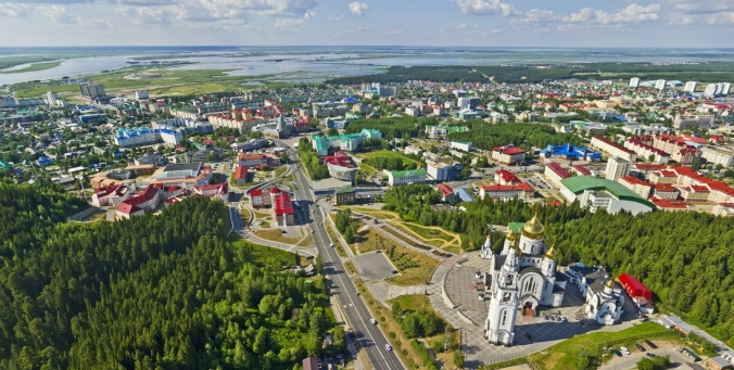
Information about the city of Khanty-Mansiysk on Wikipedia:
Link to Khanty-Mansiysk website. You can get a lot of additional information by reading them on the official website of Khanty-Mansiysk, the official portal of Khanty-Mansiysk and the government.
Official website of Khanty-Mansiysk
Map of the city of Khanty-Mansiysk. Khanty-Mansiysk Yandex Maps
Created using the Yandex service People's Map (Yandex map), when zoomed out, you can understand the location of Khanty-Mansiysk on the map of Russia. Khanty-Mansiysk Yandex maps. Interactive Yandex map of the city of Khanty-Mansiysk with street names and house numbers. The map has all the designations of Khanty-Mansiysk, it is convenient and easy to use.
On the page you can find some description of Khanty-Mansiysk. Also see the location of the city of Khanty-Mansiysk on the Yandex map. Detailed with descriptions and labels of all objects of the city.
Arriving in Ugra, every tourist dreams of visiting unique natural monuments, famous throughout Russia. Yugra is a historical name which is also known as region 186.
General information, geography and resources
The capital, or administrative center, is Khanty-Mansiysk. It, like the entire region, is part of the Ural federal district. The area of the region is 534.8 thousand square meters. km. 1.6 million people live on the territory of the Khanty-Mansi Autonomous Okrug.
The 186th region of Russia, i.e. Khanty-Mansi Autonomous Okrug, is located in the middle part of the country. The central part of the West Siberian Plain falls precisely on the territory of the district. There are uplands, lowlands, and lowlands. In the Ural part, one can observe the mid-mountain relief. The maximum heights are:
- city of Pedy - 1010 m;
- Narodnaya - 1894 m.
Regarding the climate, I would like to say that it is sharply continental. In January, the average temperature in the region is -18-24°С, and in July +15.7-18.4°С.
The Irtysh, Ob, 12 tributaries of large rivers and many small streams flow through the territory of the district. Their total number is about 30 thousand.
Animal and vegetable worlds can boast of their diversity. Depending on the territory, representatives of flora and fauna may vary.
Khanty-Mansiysk Autonomous Okrug is a leader in many respects among other subjects of the Russian Federation:
- I place - the volume of industrial production;
- I place - oil production;
- I place - electricity generation;
- II place - gas production;
- II place - receipt of taxes in the budget system;
- II place - the volume of investments in fixed assets.
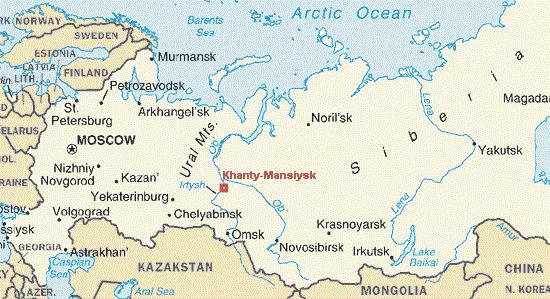
Administrative division
There are 106 municipalities in the Okrug. KhMAO is also divided into 13 urban districts:
- Kogalym.
- Nefteyugansk.
- Pyt-Yah.
- Nizhnevartovsk.
- Nyagan.
- Uray.
- Langepas.
- Surgut.
- Khanty-Mansiysk.
- Yugorsk.
- Pokachi.
- Rainbow.
- Megion.
186 region is divisible by 9 municipal districts: Berezovsky, Kondinsky, Surgutsky, Nefteyugansky, Beloyarsky, Sovetsky, Nizhnevartovsky, Oktyabrsky, Khanty-Mansiysk.
History shows that since the beginning of the 20th century, the district has been included in various areas:
- 01/17/1934 - Ob-Irtysh region;
- 12/07/1934 - Omsk;
- 07/04/1937 - Yamalo-Nenets National District;
- 08/14/1944 - Tyumen region.
transport and logistic
186 The region is quite developed in the transport sector. Thus, there are 8 airports and 3 river ports in the Okrug.
Air hubs are located in Khanty-Mansiysk, Beloyarsk, Nyagan, Kondinsky, Kogalym, Urai, Sovetsky district and Berezovo.
River ports: Serginsky, Nizhnevartovsky, Surgut.
Attractions KhMAO
Among all the sights, a special niche is filled with natural monuments. The 186th region has 8 unique nature reserves, which are under the protection of the state. Naturally, they are open to tourists. But the main goal is still to preserve the original appearance.
- Ovechiy Island is located in the Nizhnevartovsk region (protection of a unique natural ecological system).
- The Khanty-Mansiysk hills are located in the vicinity of the capital. Open for tourism and recreation.
- The forest-bog zone "Big Kayukovo" in the Surgut region. On the territory of this, the main types of swamps and forests characteristic of Western Siberia have been preserved.
- Shapshin cedar forests are located in the Khanty-Mansiysk region. Natural landscapes rich in cedar plantations are preserved here.
- Smolny Island is the pride of the Nizhnevartovsk region, where a unique natural ecosystem is preserved.
- Cheuska cedar forests are located in the Nefteyugansk region. Sanatorium and recreational significance has been assigned to this natural monument.
- Lake Range-Tur is famous for its special ecosystem: on the coast there are massifs of light pine forests, nesting places for the white-tailed eagle.
- The system of lakes Ai-Novyinklor, Un-Novyinklor is located in the Beloyarsky district. A unique complex of lakes is protected and studied here.
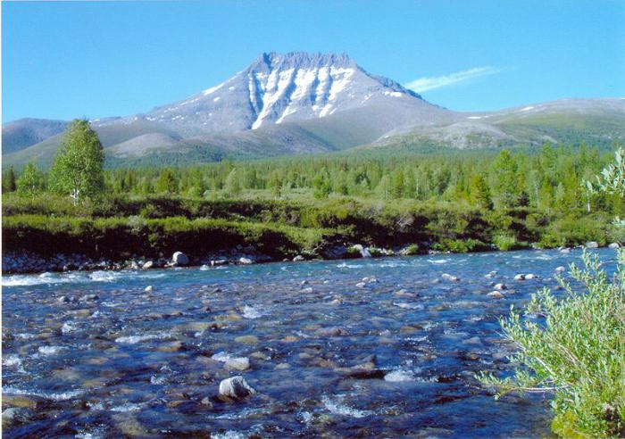
So, if you are interested in the question: “186 - which region?”, Then the answer is unequivocal: this is the Khanty-Mansiysk Autonomous Okrug, famous for its natural monuments. Tourists will be interested in visiting historical and protected places, enjoying the combination of city life and the breath of nature.


